

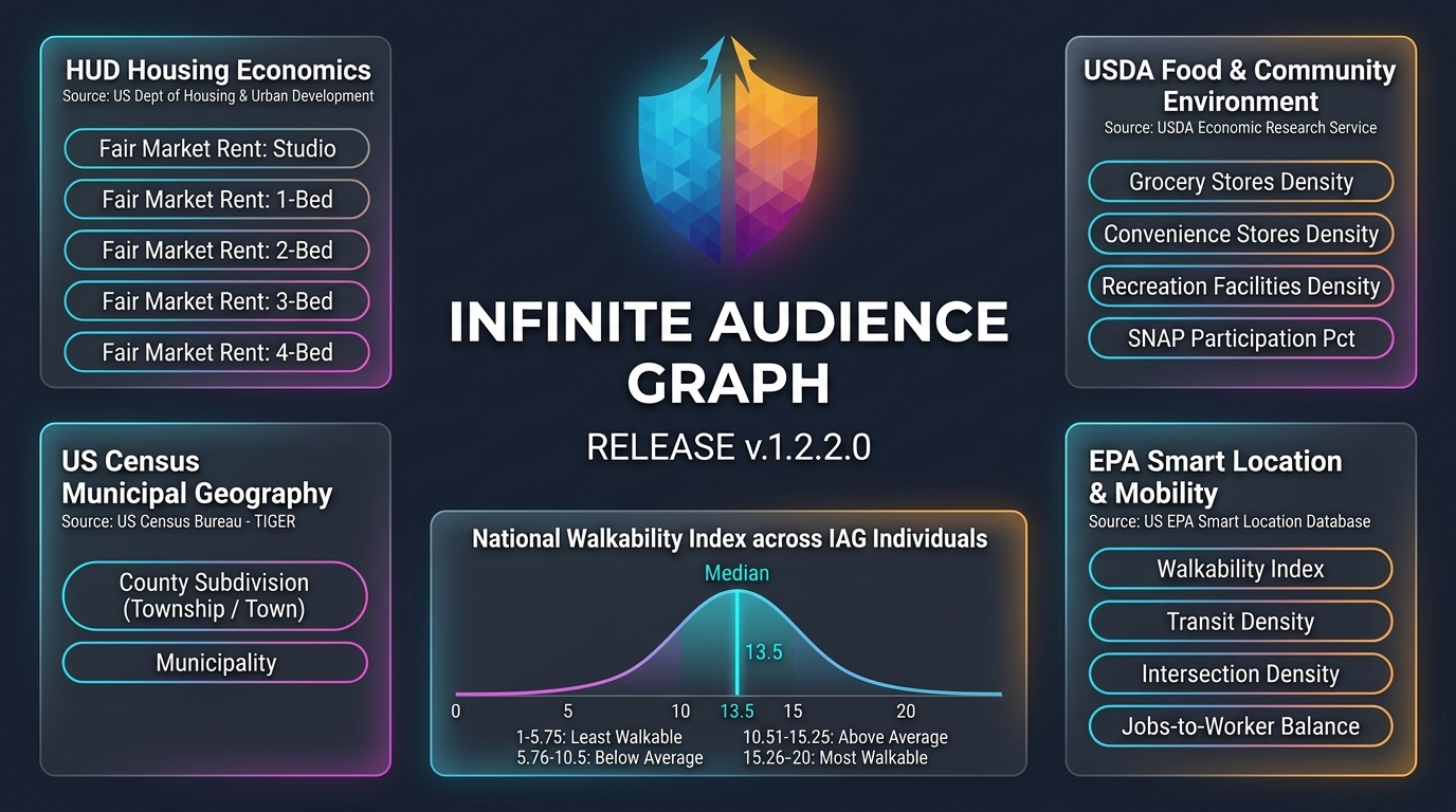
What's New in v1.2.2.0: • Municipal Geography & MCDs: County subdivision and primary municipality resolution across 35,629 jurisdictions. • Behavioral & Lifestyle: New gamer profile (is_gamer) identifying active video game enthusiasts. • Contact Point Intelligence: Symmetrical contact STRUCT arrays with domain classification and ranked reachability confidence. • Neighborhood, Housing & Mobility: Walkability and transit frequency, food retail density, fair market rental rates, and wildfire risk.
Added county subdivision and primary municipality resolution from US Census TIGER 2026, enabling precise sub-county targeting across New England towns and Midwestern townships.
Harmonized emails and phones into symmetrical schema arrays equipped with reachability confidence scores, domain classification, and ranked priority ordering.
Integrated national walkability indices, transit service frequency, street intersection density, and household vehicle ownership distributions.
Enriched consumer profiles with grocery and recreation density, SNAP participation rates, and Section 8 50th percentile Fair Market Rents.
Municipal Geography & Local Administration
Targeting consumers based strictly on county boundaries often fails to align with real-world municipal boundaries and local purchasing patterns. With v1.2.2.0, the graph resolves every household against 35,629 Minor Civil Divisions (MCDs), Census County Divisions (CCDs), and incorporated towns. This enables localized segmentation matching legal municipal jurisdictions.
Ranked Reachability & Contact Confidence
Reaching consumers across modern omnichannel campaigns requires clean, verified contact points. v1.2.2.0 restructures contact point arrays into symmetrical STRUCT schemas with verified reachability scores, business/personal/governmental domain classifications, and priority indexing so the most reachable contact always ranks first.
Neighborhood, Housing & Mobility Context
Through integration with the EPA Smart Location Database, USDA Economic Research Service, and HUD, v1.2.2.0 equips enterprise analytics with neighborhood lifestyle dimensions including pedestrian walkability, transit frequency, food retail density, and fair market rental affordability.
Explore the full 543-attribute schema in our public documentation catalog or subscribe to updates in the public repository.